Magnetometry
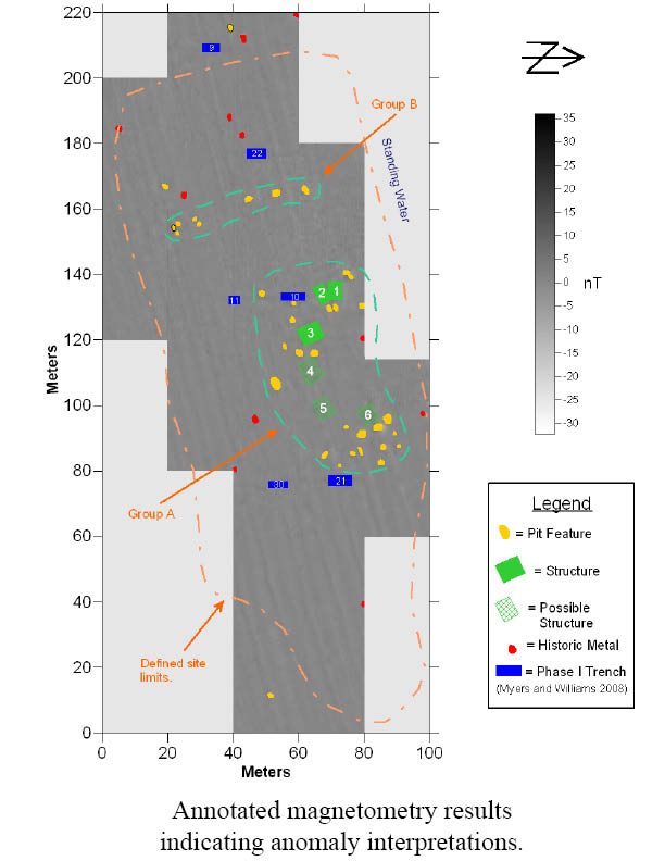
ARG uses remote sensing to identify subsurface features and buried structures.
Magnetometry surveys save time and money by providing a pre-excavation view of subsurface cultural features:
-
Sites buried by flood-deposited silt
-
Identifying high-potential areas prior to Phase II and Phase III excavations
Magnetometry surveys can also assist in cemetery relocation through identifying unmarked graves.

Magnetometry survey in Indiana.